
Geoconservation is the practice of recognising, protecting and managing sites and landscapes which have value for their geology or geomorphology.
Scotland has over 1000 sites that are designated as important for geology and geomorphology at a national or local level.
Together, they represent Scotland’s world-class geodiversity, containing the evidence of geological processes of the past and present, important fossils and minerals and demonstrate the fundamental links between geology, processes, landscape, people and nature.
The Scottish Geology Trust’s Geosites project aims to bring information about all these sites together in one place, to make it easy for people to report issues with sites, and to share information.
- Sites of Special Scientific Interest (SSSI) are areas of land with special interest for their flora or fauna, geology or geomorphology, with statutory notification by NatureScot.
- The Geological Conservation Review (GCR) is the register of known nationally and internationally important Earth science (geological and geomorphological) sites in Great Britain. These sites were identified in comprehensive expert surveys, started in 1977. There are 880 GCR sites in Scotland, most protected as geological SSSI.
- Local Geodiversity Sites (LGS) are sites of local interest, designated by local authorities and included in Local Development Plans.
Geoconservation of sites of national and international importance
The Geological Conservation Review (GCR) is a rigorous process to select areas of national and international importance for their geology and geomorphology within Britain. Started in 1977, the GCR is an ongoing process to identify the sites needed to show all the key scientific elements of the Earth heritage of Britain.
There are 880 GCR sites in Scotland. Most have statutory protection through designation as geological Sites of Special Scientific Interest (SSSIs). However, more than 200 GCR sites, known as ‘unnotified GCR sites’, have no protective SSSI status. Significant areas of 30 further GCR sites are similarly unprotected.
National Park authorities and some local authorities, therefore, treat unnotified GCR sites as ‘candidate SSSIs’ and afford them the same protection as SSSIs. Some unnotified GCR sites are also Local Geodiversity Sites (see below). As such, they are at least given the same protection as locally important sites – though they are actually nationally or internationally important.
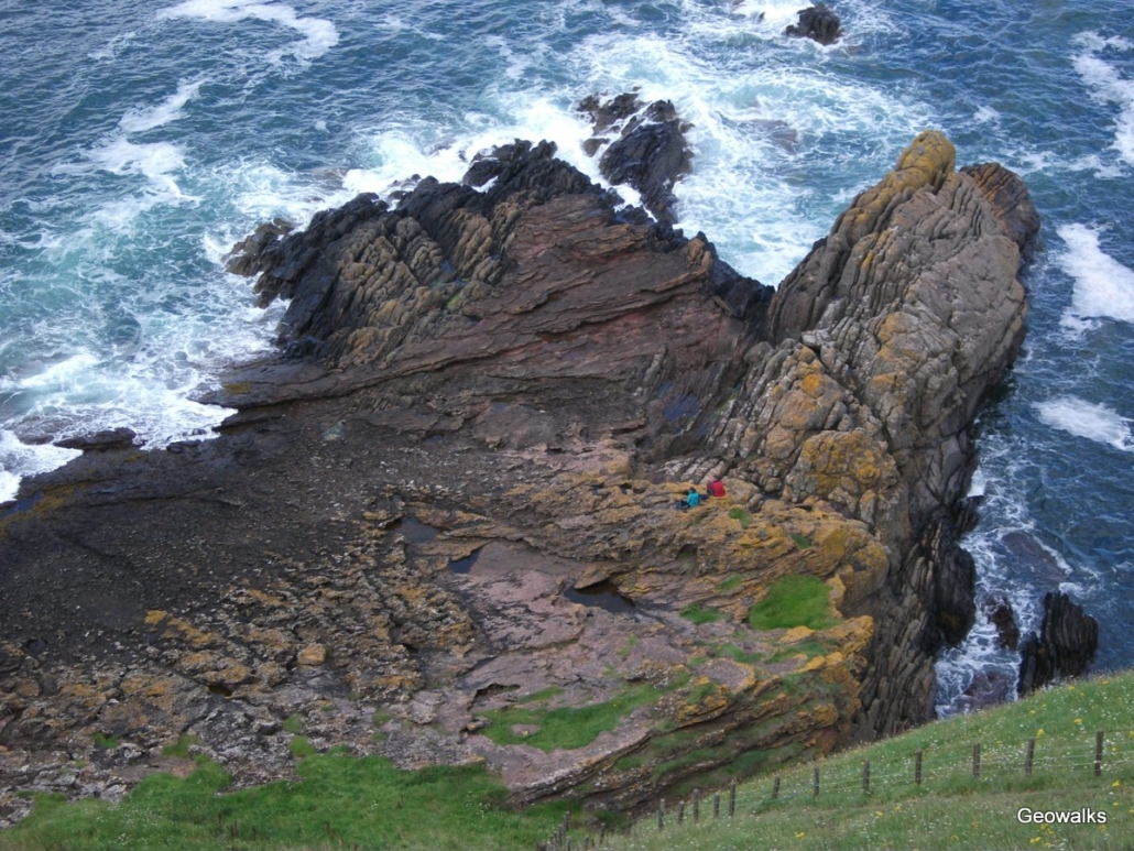 Siccar Point, in south-east Scotland is Scotland’s most important geological site and of international importance. It is a Geological Conservation Review site and designated as a geological Site of Special Scientific Interest.
Conserving and Interpreting Scotland’s Local Geodiversity Sites
Local Geodiversity Sites are the most important places for geology, geomorphology and soils outside statutorily protected nature reserves and Sites of Special Scientific Interest (SSSI). In Scotland, there is a long history of work by local geoconservation groups to designate and promote Local Geodiversity Sites. The designation of Local Geodiversity Sites – sometimes classed as Local Nature Conservation Sites (LNCS) – is one way of recognising and protecting important earth science and landscape features for future generations to enjoy.
This work is done by local geoconservation groups, who are members the national network, GeoConservation UK (GCUK). These groups work with local authorities to designate Local Geodiversity Sites, and work to raise awareness of sites and geodiversity through publicity such as leaflets, booklets, posters, interpretation boards and websites, and by developing access and educational usage of sites and trails. Local Geodiversity Sites were previously known as RIGS, Regionally Important Geological and Geomorphological Sites.
Geoconservation in Scotland: Online Training Course
The Scottish Geology Trust is keen to support and promote geoconservation in Scotland. We would like to encourage more people to get involved in identifying, monitoring and promoting LGS in Scotland, by supporting existing local geoconservation groups and perhaps in time establishing new groups.
This free online training course, delivered in partnership with Geoconservation UK in May 2021, consisted of three sessions that gave an overview of geoconservation in Scotland and the monitoring and designation of Local Geodiversity Sites. Recordings of the presentations are available.
Link to Online Training Course recordings and further information
Local Geodiversity Sites – example Site Designation Form
This form is provided, courtesy of Lothian and Borders GeoConservation, to assist local groups in designating Local Geodiversity Sites.
Local Geodiversity Sites in Scotland – site designation form
Site Condition Monitoring of Local Geodiversity Sites
This form is provided to assist local groups in monitoring Local Geodiversity Sites.
Site condition monitoring form | Site condition monitoring form guidance
Local Geoconservation Groups in Scotland
Note that not all of these groups are currently active.
Geodiversity: Argyll and the Islands – www.argyllgeology.co.uk
Geod (Geodiversity Dumfries & Galloway) – geodg.wordpress.com
geoHeritage Fife – www.st-andrews.ac.uk/earth-sciences/outreach/geoheritage/
Lothian and Borders GeoConservation – www.edinburghgeolsoc.org/home/geoconservation/lothian-and-borders-geoconservation/
Strathclyde Geoconservation – www.geologyglasgow.org.uk/geoconservation/strathclyde/
Tayside Geodiversity – www.taysidebiodiversity.co.uk/tayside-biodiversity-partners/tayside-geodiversity-introduction/
Representatives and volunteers on these groups can include local professional and amateur geologist volunteers, local authority planners, countryside rangers, museum and education services, Scottish Natural Heritage (Advisory and Area staff) and the British Geological Survey (BGS).
The Lothian & Borders RIGS Group (now Lothian & Borders Geoconservation) was the first to be founded in September 1992. It has been a successful group with respect to both designation and interpretation of sites. Lothian & Borders has both a Committee and a Volunteer Group. The Committee meets every year and liaises with Local Authorities, monitors progress, designates Local Geodiversity Sites, and directs the efforts of the Volunteer Group in producing interpretation leaflets and posters, managing and clearing sites and visiting potential sites.